
PAZ Super Sites
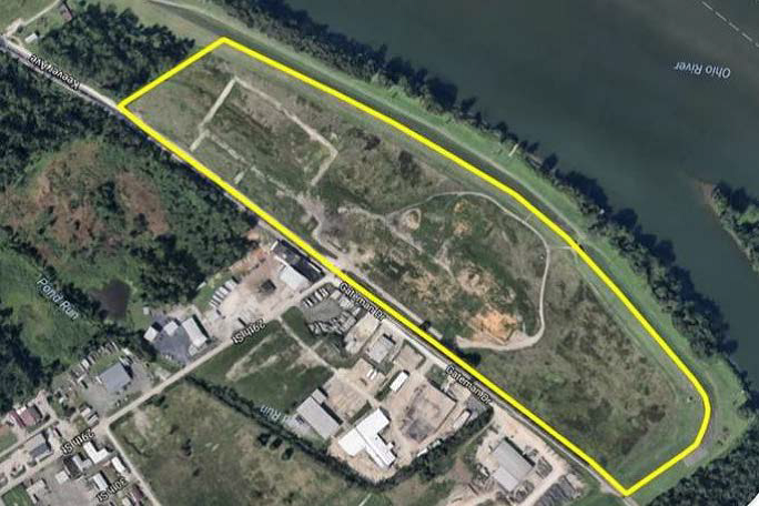
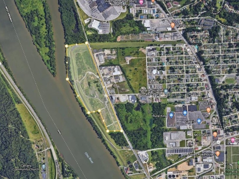
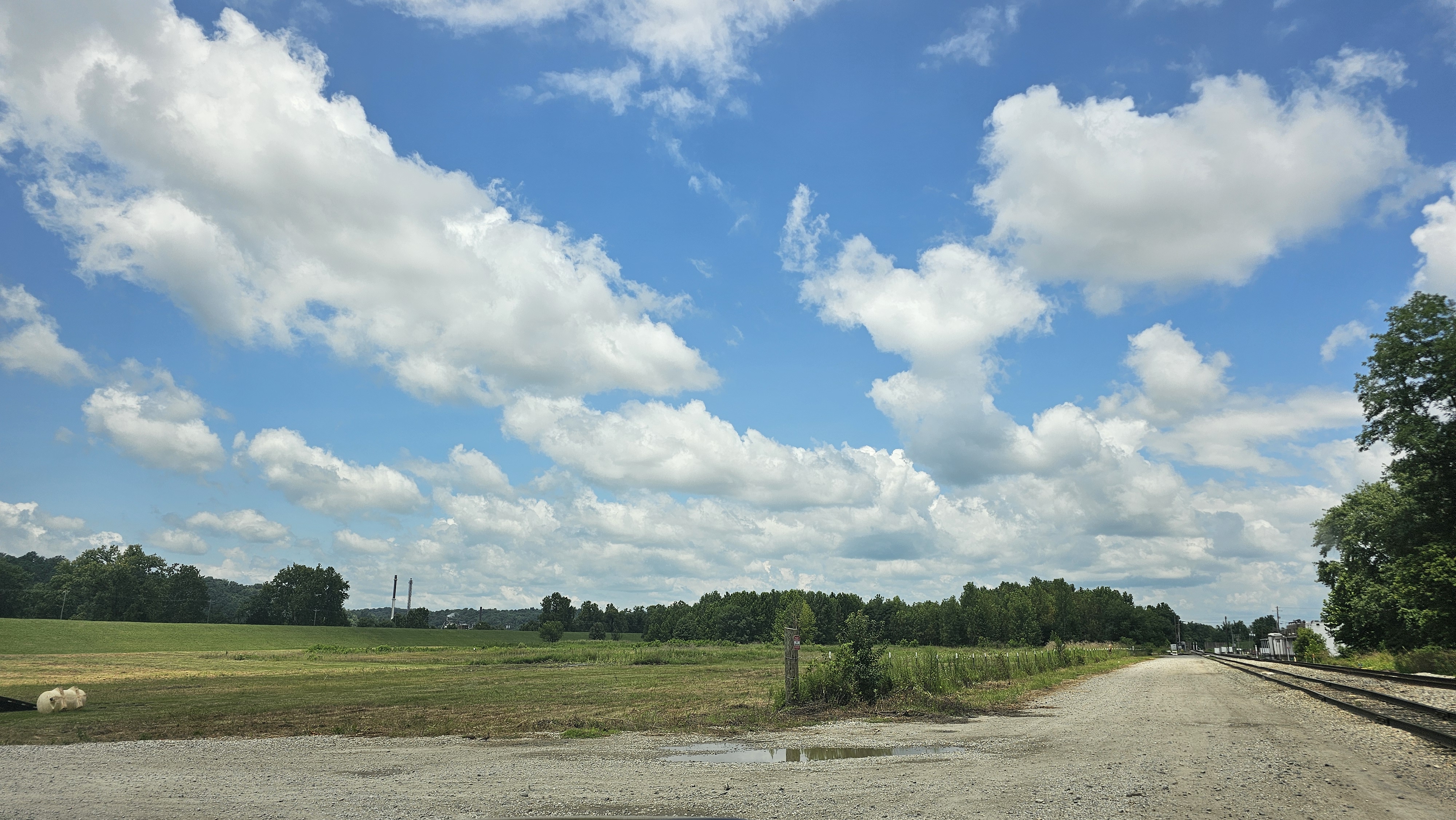
Parkersburg Steel Yard (Parkersburg, Wood County, WV)
00 29th Street
Parkersburg, West Virginia 26101
Parkersburg, West Virginia 26101
CIty Limits: Yes
County: Wood
Latitude: 39.2884
Longitude: -81.5593
Industrial Park: No
Zoning: Yes
Covenants: No
Industry Concentration Designation: WV Polymer Alliance Zone
Flood Hazard Zone: No
Land Size
Total Acres: 60 AC
Developable Acres: 46 AC
Will owner subdivide property: Negotiable
Acreage range that owner will subdivide property: Negotiable
Property for lease/sale: Negotiable
Building Size: NA
Transportation
Interstate/4-Lane Highway: 2.5 MILES to US 50 & 7.5 MILES to I-77
Commercial Airport: 10 MILES to MOV Regional Airport
Rail: Yes
Served by: CSX Mainline
Spur: No
Navigable River: Yes
Access: Ohio River
Mooring Cells: Yes
Utilities
Electricity: Yes
Electric Utility Name: Mon Power
Proximity to Power Line: 7.2kV/12.47kV: On-site ; 23kV: 1,500 FT from site; 138kV: 1,500 FT from site
Transmission Voltage: Single Circuit-Medium Voltage (7.2kV/12.47kV): On-site; Single Circuit-Medium Voltage (23kV): 1,500 FT from site; Dual Circuit-High Voltage (138kV): 1,500 FT from site
Phase: 3
Distance to substation: 3,200 FT
Available Capacity (MW): 2 MW (current circuit capacity) - Available Capacity (Available Transfer Capability/ATC) is >
Gas: Yes
Gas Utility Name: Hope Gas
Size of Gas Main: 2 IN (plastic)
Proximity to Primary Gas Main: 0.28 MILES
Gas Pressure: Medium (60 PSI-MAOP)
Gas Pressure (Second Main)
Size of Second Gas Main: 6 IN (steel)
Proximity to Second Gas Main: 0.30 MILES
Gas Pressure (Second Main): Medium (60 PSI-MAOP)
Water: Yes
Water Utility Name: Parkersburg Utility Board
Proximity to Water Main: On-site
Size of Water Main: 14 IN
Excess Capacity of Treatment Plant: 1,677,600 GPD
Sewer: Yes
Sewer Utility Name: Parkersburg Utility Board
Proximity to Sewer Main: 100 FT
Size of Sewer Main: 16 IN
Excess Capacity of Sewer Treatment Plant: 86,400 GPD
Telecom: Yes
Telecom Utility Name: Optimum & Miller Communications
Broadband: CityNet, Optimum & CAS
- Broadband (Fiber): No (CityNet is 5,280 FT)
- Broadband (Cable): Yes (Optimum & CAS)
- Broadband (DSL): Yes (Frontier)
Quick Facts
- The history of the Parkersburg Steel Yard site, now vacant, dates to the origins of the Parkersburg Steel Company, later doing business as Dover Parkersburg, a prominent manufacturer of stamped tinware, metalware, and steel items under the ownership of the Louis Berkman LLC.
- The plant operated as the Parkersburg Steel Company, producing stamped and pieced tinware. In March 1953, it acquired additional stamped tinware business and equipment from NESCO (National Enameling and Stamping Company) to expand its production capacity in Parkersburg. The facility and company became affiliated with industrialist Louis Berkman’s network of steel and manufacturing holdings, which included Follansbee Steel. Over the decades, the plant was known as Dover Parkersburg, producing various galvanized and blue steel items
- The Parkersburg-based corporate entity underwent structural changes, including a 1986 merger filing merging Follansbee Steel Corporation into the Parkersburg Steel Company.
- Under the Dover Parkersburg name, the facility continued structural steel fabrication, skirting, and metalware production into the 2000s before experiencing major workforce reductions and closures heading toward 2010.
- The Parkersburg Steel Yard site has been cleared, is level, and prime for industrial uses.
- Ohio River barge cells and unloading platform remain onsite.
- The site has a Phase 1 and Phase 2 ESA.
- The strategic advantage of this park is the abundant and inexpensive natural gas and natural gas liquids (NGLs) from the Marcellus and Utica shale reserves.
- Centrally-located in a regional hub for heavy metals, chemicals, and polymer industries, large consumer population, and highly skilled labor pool.
Contact Information
WOOD COUNTY DEVELOPMENT AUTHORITY
Lindsey Piersol, Executive Director
(304) 422-5650
lindsey@developwoodcountywv.com
Loading...
No Records Found
Sorry, no records were found. Please adjust your search criteria and try again.
Maps failed to load
Sorry, unable to load the Maps API.